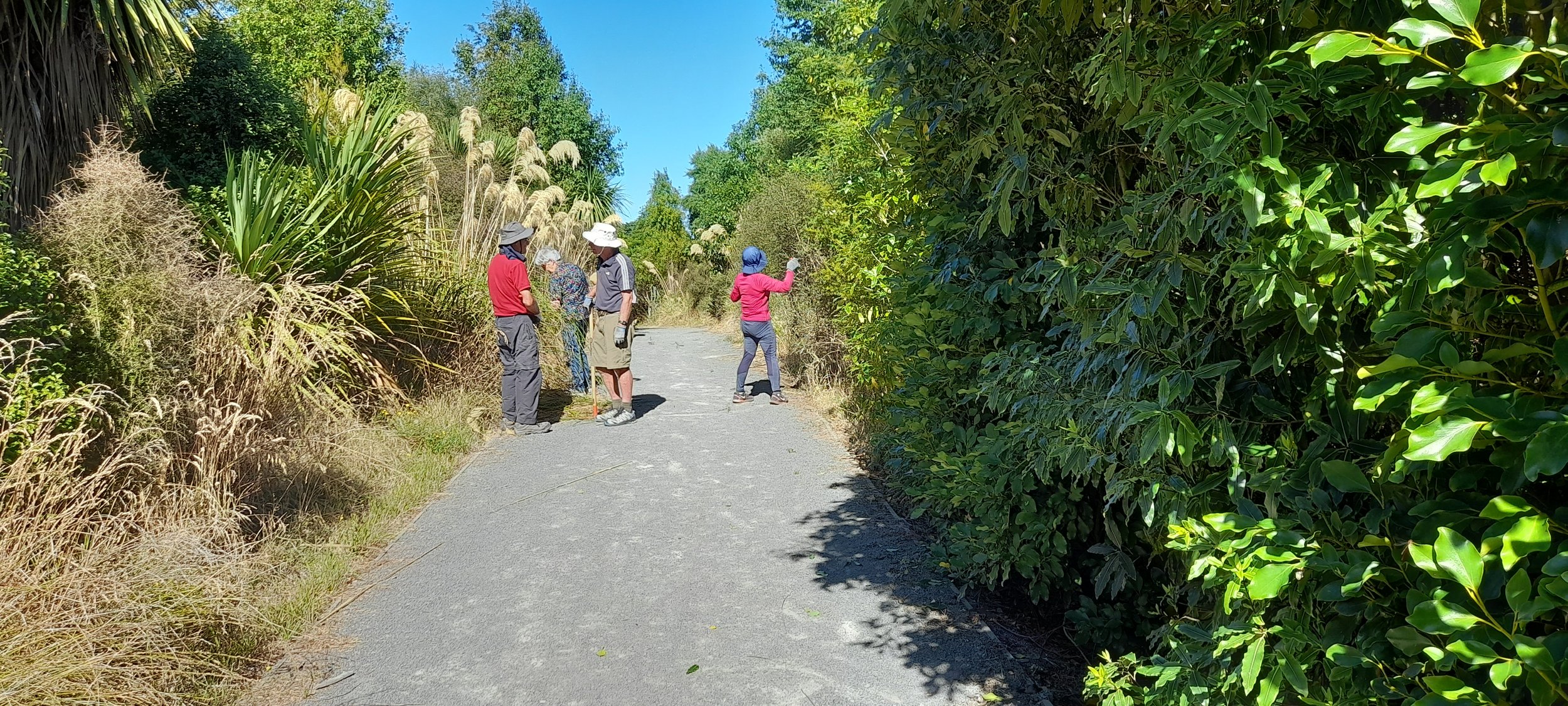
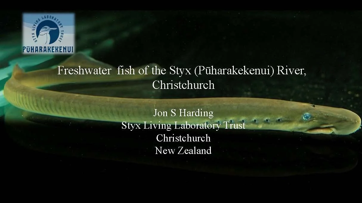
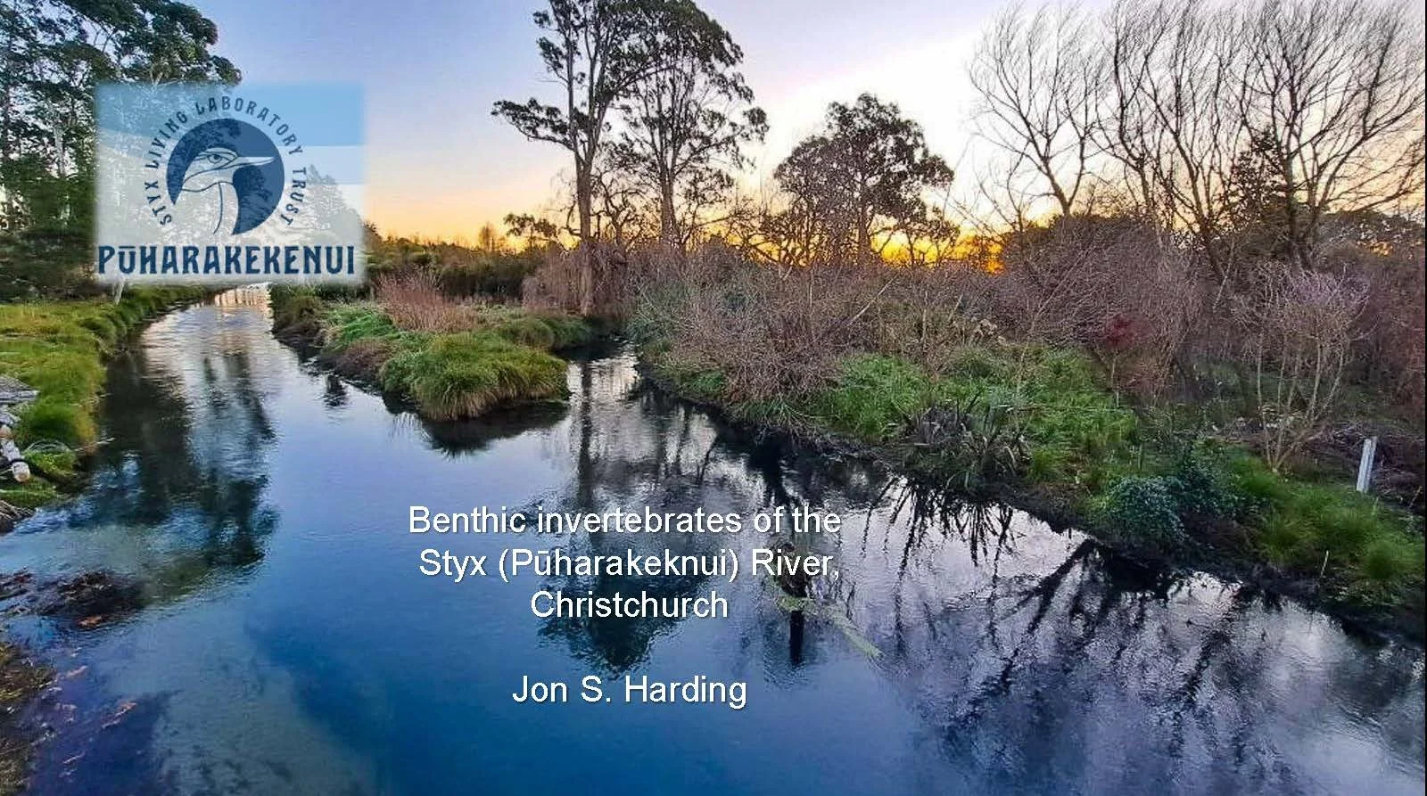
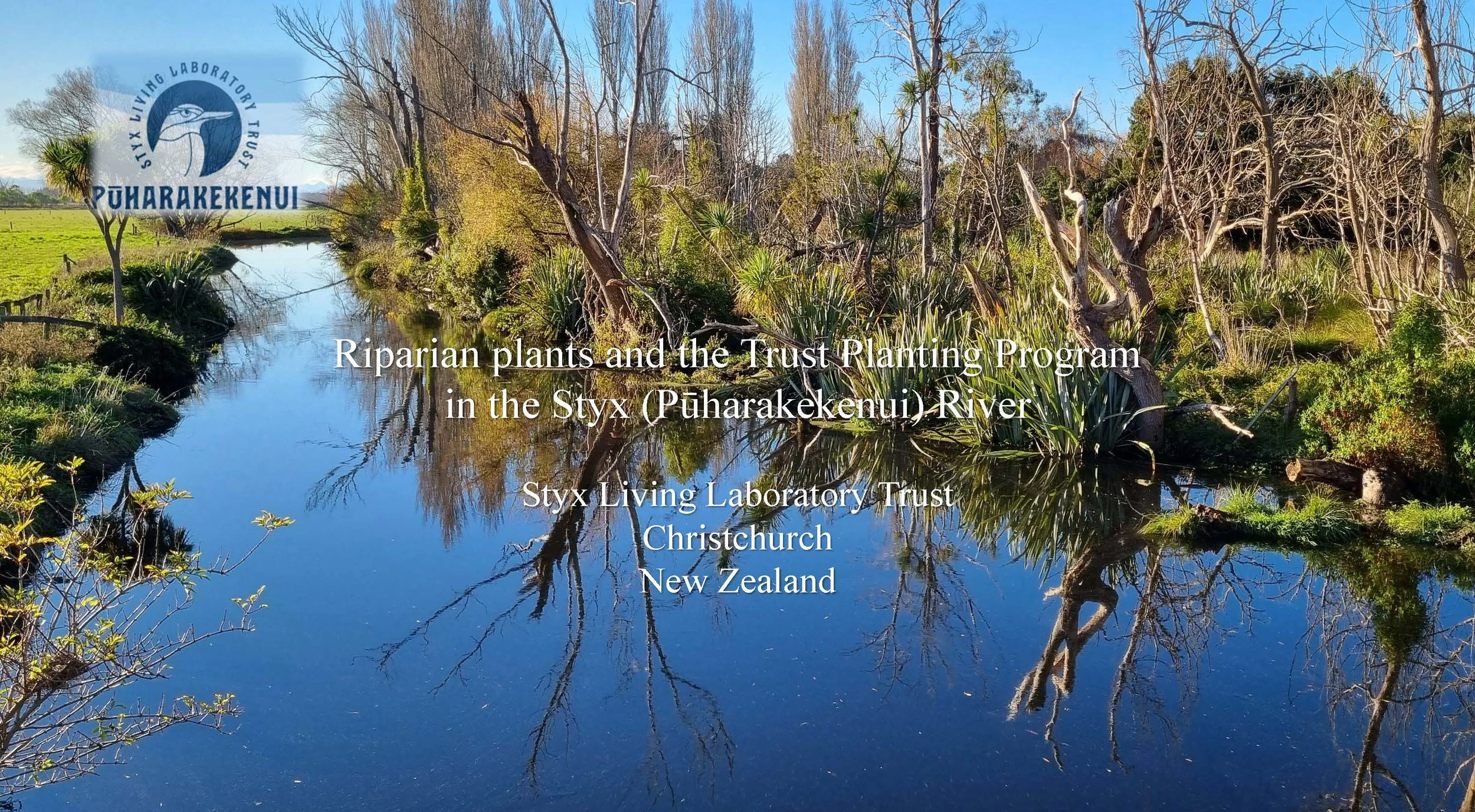
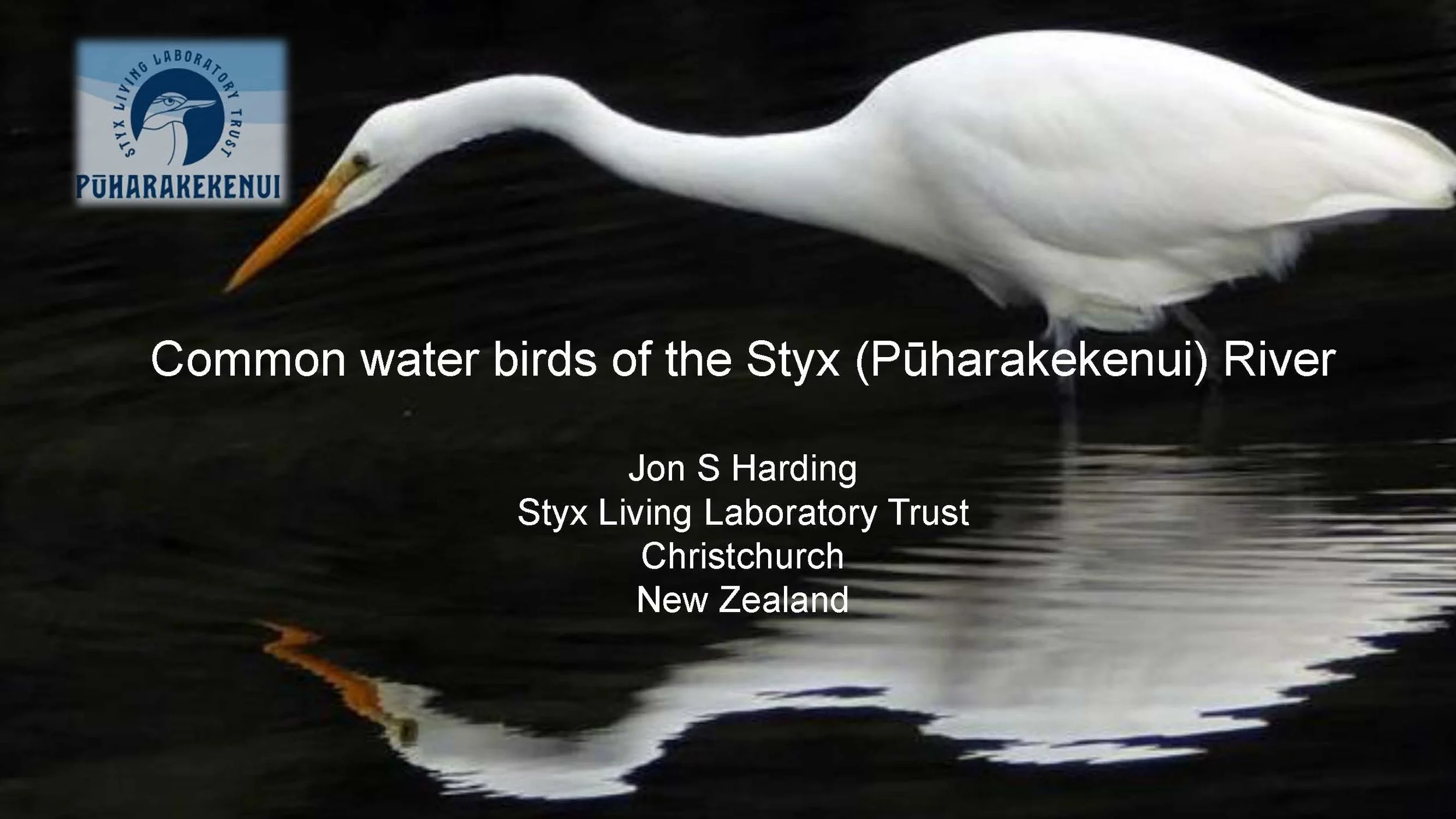
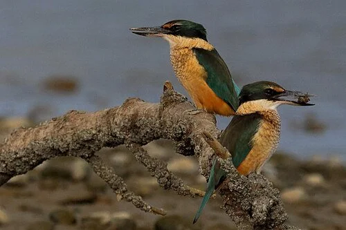
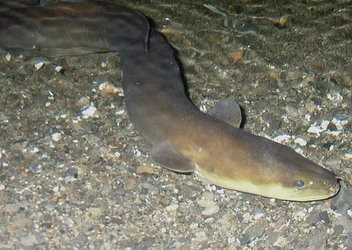
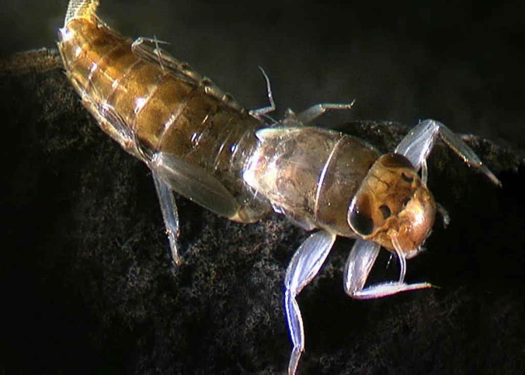
The environment.
-
The history of the Styx River is closely related to the formation of the Canterbury Plains.
In earlier times the flow of the Styx River would have been provided by a combination of spring water and channels connecting with the Waimakariri River.
There is a strip of very young soils along the middle reaches of the Styx River and Smacks Creek that suggest a recent connection between the two river systems.
Today the Styx River consists of a low-gradient, narrow, meandering, single-thread channel that is incised into a fan surface largely formed by sedimentation from the Waimakariri River.
The springs that feed the Styx River ecosystem mainly occur along a line that is close to the western limit of the surface confining layer of fine-grained sediment overlying gravel, and probably indicate the presence of gravel channels within the Springston or Christchurch Formation. -
The Styx River, 24.8 kilometres long, has two main tributaries, Smacks Creek and Kaputone Stream. Several other smaller waterways, both natural and constructed, drain into the Styx River before it enters the sea north of the city of Christchurch via Brooklands Lagoon and the Waimakariri River.
As indicated by the Black Map drawn in 1856, when early Europeans settled in the area, the Styx River and its tributaries were surrounded by extensive wetlands. There was also a possible tributary link to the much larger Waimakariri River. -
Bush Birds
Native bush birds occur along the full length of the Styx River corridor utilising native revegetation sites, willow-dominated riparian woodlands, and other types of exotic tree/shrub cover. The three most abundant species are Silvereye (Zosterops lateralis), South Island Fantail (Rhipidura fulginosa) and Grey Warbler (Geregone igata), which all have resident breeding populations that are augmented in autumn/winter by an influx of birds from habitats elsewhere.
The Shining Cuckoo (Chrysococcyx lucidus) is a spring/summer migrant, laying its eggs in the nests of Grey Warbler "foster parents". These birds are found mainly in stands of willow, eucalypt and some of the taller native plantings, such as at Styx Mill Conservation Reserve. This species leaves New Zealand in April and migrates to wintering areas on islands in the South-West Pacific. Another cuckoo, the Long-tailed Cuckoo (Eudynamys taitensis) is a rare visitor to the Styx catchmenrt, having been recently been recorded in the Lower Styx Road area near Spencerville. It is also a spring/summer migrant.
Increases in the local abundance and range of two native species, Bellbird (Anthornis melanura) and New Zealand Pigeon or Kereru ( Hemiphaga novaeseelandiae) have been evident over the last decade. Bellbirds were absent until the mid 1990s, but now occur along the full length of the Styx River from Harewood to Brooklands. They are present year-round in some sites and have almost certainly now established as a resident-breeding species, rather than just a winter visitor (as was their status from the mid 1990s to about 2007). New Zealand Pigeons regularly occur (probably as seasonal visitors) in the Brooklands area along the lower reaches of the Styx, and are occasionally seen further upstream, including the Styx Mill Basin area.
Birds of prey in the Styx catchment number three species - the introduced and quite common Little Owl (Athene noctua), as well as the ubiquitious Australian Harrier (Circus approximans) and a very small number of New Zealand Falcons (Falco novaeseelandiae). Over the last few years falcons have been regularly sighted in the area between Lower Styx Road, Waitikiri Golfcourse and Bottle lake Forest.
Quality habitats such as native bush plantings, mixed exotic/native woodland, and exotic plantation have great potential for native bush birds. Although not currently present, species such as Brown Creeper (Mohoua novaeseelandiae), South island Tomtit (Petroica macrocephala), Tui (Prosthemadera novaeseelandiae), Morepork (Ninox novaeseelandiae),and Buff Weka (Gallirallus australis hectori) would all likely do well if released into suitable habitats within the Styx catchment in coming years.
A wide range of introduced birds occur along the Styx River, including several species of ornithological interest. The Australian Crested Pigeon (Geophaps lophotes) may be establishing in the upper part of the catchment, particularly in the Gardiner's Road area. Groups of up to 6 birds have been sighted regularly, and although these birds have almost certainly escaped from captivity (rather than flown across from Australia), if breeding is proven it will be the first confirmed instance anywhere in New Zealand. Another pigeon, the Barbary Dove (Streptopelia roseogrisea) appears to have established a small population at the other end of the catchment in the Burwood - Brooklands area. The Styx catchment therefore has the distinction of being one of the few areas in New Zealand where four species of pigeon occur (NZ Pigeoon, Australian Crested Pigeon, Barbary Dive and Rock Pigeon).
Introduced gamebirds that utilise farmland and woodland habitats also utilise the catchment. They include Pheasant (Phasians colchicus), California Quail (Callipepla californica), Peafowl (Pavo cristatus) and the rare Cirl Bunting (Emberiza cirlus).
Habitat Requirements
To ensure that native bush birds are part of the Styx landscape in the long term, consideration needs to be given to their habitat requirements, in particular the shape, size,spatial arrangement, and structure of forest habitats. These attributes are discussed in more detail below.
SHAPE OF FOREST HABITATS
A forest habitat patch should ideally be circular in order to reduce the edge-to-area ratio and thus the 'edge effect', as opposed to linear that is typical of riparian corridors and esplanade reserves.
As a rule-of-thumb 50 metres inside the edge of a forest is adversely affected by edge-related problems. These include a high incidence of exotic plant pest species, greater degree of competition from exotic birds, more wind, higher temperatures, higher light and a decreased soil moisture environment. Therefore any area of land to be considered for forest establishment must take these issues into account and attempt to minimise the edge-to-area ratio of the forest patch.
SPATIAL ARRANGEMENT OF FOREST HABITATS
The functional connectivity of forest habitat patches is dependent on their spatial arrangement. These patches need not be physically adjacent to one another to provide for dispersal of most bush bird species between sites, however they must be near enough to one another to provide a reasonable probability that birds (and other organisms) are able to disperse between them across areas of non-habitat.
While it may not be essential that every large forest patch is physically connected by a forest corridor, a landscape characterised by a series of habitat ‘stepping-stones’ that provide a degree of functional connectivity is desirable. In achieving this, and based on empirical data on plant dispersion and inferred minimum density of forest patches, Landcare Research suggest smaller habitat patches of 1 to 2 hectares in area be no more than 1000m apart, with larger forested areas at 4000 to 5000m distances across the landscape. These guidelines have been considered in conjunction with the tui population viability analysis. Based on this understanding a spatial arrangement of habitat patches across the catchment is illustrated in the attached plan. These patch requirements are being incorporated into overall planning for green corridors in the Styx catchment.
Wetland Birds
Current Status
In recent years Christchurch has seen a renaissance of indigenous wetland birds as a result of riparian and wetland habitat restoration throughout the city. Notable examples include the New Zealand scaup and paradise shelduck; species which until the 1990’s were absent from the urban environment, and normally only encountered in high country lakes and rivers. The New Zealand scaup is now so prevalent in the City, that since the late 1980’s the Christchurch population has increased from an estimated 200 birds to 7500. Almost 25% of the worlds entire population of this species is now residing on Christchurch waterways. Over the past five years paradise shelduck have also begun to re-colonise the city and are now a common sight throughout Christchurch. The Australasian crested grebe; a critically endangered species normally seen only on high country lakes has recently been reported within the Christchurch area on the lower Styx River, Roto Kohatu Reserve, and the Heathcote River. Well managed, natural environments within urban areas have significant potential to provide good wildlife habitat and offer a critical conservation function outside the Department of Conservation estate.
Today the Styx Catchment supports a rich avifauna with a relatively high representation of native species compared to other city rivers. For example, the river and its margins support six species of native waterfowl (Black Swan, Paradise Shelduck, Grey Duck, New Zealand Shoveler, Grey Teal, New Zealand Scaup); three herons (White Heron, White-faced Heron, Australasian Bittern); three cormorants (Black Cormorant, Little Cormorant, Little Black Cormorant); three rails (Pukeko, Australasian Coot, Marsh Crake); and two waders (Pied Stilt, Spur-winged Plover). Further protection and enhancement of riparian and wetland habitat along the Styx River and its tributaries is likely to also see increases in a range of other species which have either become locally extinct or are rare visitors to the City. This has been exemplified recently by sightings of critically endangered Australasian crested grebe in three locations in Christchurch, including the Styx River mouth.
Habitat Requirements
Three key requirements are essential for the long-term protection and enhancement of wetland bird populations on the Styx River and associated waterways. They are the protection and enhancement of the Styx River, Kaputone Creek, and Smacks Creek as ecological corridors, the protection and restoration of core wetland habitats and the creation of buffers around these habitats and corridors. These requirements are discussed in more detail below.
(i) Protection & enhancement of the river as an ‘Ecological Corridor’
Waterways are natural ecological corridors, providing continuous living habitat that facilitate the dispersal, migration and genetic interchange of populations of many species of plants and animals. Within the context of the highly modified Christchurch City and Canterbury Plains, the Styx River and its tributaries provide an important ecological corridor within the northern part of Christchurch City. This corridor needs to be protected and enhanced as the catchment becomes urbanised.
(ii) Core wetland habitats
Core wetland habitats provide reliable roosting, feeding and breeding opportunities for birds. At crucial times, such as at night and while nesting, they are able to base themselves in these areas and then disperse through the surrounding landscape at other times of the day. Many of the core habitat areas, such as the ponds at Styx Mill Conservation Reserve and Janet Stewart Reserve, have already attracted large numbers of wetland birds. This has resulted in an increase in bird populations within the Styx Catchment and an increase in bird species richness on those areas adjacent to these core wetland habitats.
Care needs to be taken in the design and development of wetland habitat to ensure that undesirable waterfowl species are not attracted to these areas. Undesirable species include canadian geese, black swans and to a certain extent mallard ducks which contribute to poor water quality, fouling of amenity areas as well as posing potential bird-strike hazards. These issues can largely be mitigated through good design.
The Styx Catchment lends itself to the development to the following types of core wetland habitats -
(a) Natural low-lying areas along the main river and tributary streams
Lowlying back waters occur mainly through the actions of the former Christchurch Drainage Board and their efforts to improve drainage through straightening of waterways. These areas provide a series of core habitat “stepping stones” along the length of the river and streams that are utilised mainly by nesting waterfowl, swampbirds, and harriers. These wetlands can also take the form of kahikatea dominated swamp forest where it is desirable to provide forested areas to complement core dryland forest areas.
(b) Instream ponding areas
These areas are created by diverting or restricting flows within the waterway and result in areas of open water that attract mainly waterfowl and cormorants.
(c) Surface water ephemeral ponding areas
These wetlands consist of farm paddocks or sports fields that are flooded after heavy or prolonged rain and waterlogged through the autumn, winter and spring months. These areas are utilised as feeding habitat by the larger waterfowl, gulls and herons, and as feeding and nesting habitat by waders. As with the natural low lying areas described above, ephemeral ponding areas may also take the form of a forested area.
(d) Hinterland wetlands
Hinterland wetlands such as Bottle Lake and ephemeral ponding areas (former wetlands in the Ouruhia-Spencerville Road area) have potential for restoration and would support a range of feeding and nesting waterfowl, swampbirds, waders and herons, and again pave the potential for native forest restoration.
(e) Salt marsh and salt meadow habitats
Salt marsh and salt meadow predominate in areas that remain, or were once dominated by a tidal flooding regime. The current condition of these habitats ranges from outstanding to highly degraded. They support nesting, roosting and feeding swampbirds, waders, waterfowl and herons.
(iii) Buffers
The Styx River catchment is currently undergoing a rapid transformation from a largely rural catchment to one that is predominantly urban. Within the next 50 years large stretches of the river and its tributaries are likely to become absorbed into expanding suburbs and growing satellite settlements (eg Brooklands, Spencerville) while remaining stretches are likely to border more intensively managed farmland. If the Styx River corridor is to retain its integrity as a habitat for wildlife and as a landscape feature in the long term then buffer zones will be needed to screen river habitats from the impacts of adjacent landuses.
Buffer zones have multiple uses: They reduce the impact of edge effects such as noise, artificial light, pollution, smoke, movement of vehicles, activities of people, and the sense of being closed in. Buffer zones can also reduce the impact of predatory domestic animals (eg cats, dogs) by making access to core habitats more difficult, and putting distance between core habitats and the home territories of domestic animals. The effect is that lower numbers of domestic animals penetrate completely through the buffer into the core area. Buffer zones also expand the area of usable habitat available, making long and narrow habitats (such as a river corridor) more viable for wildlife and plants.
Although width requirements for buffers will vary depending on the site, a recommended guideline is to allow 50+ metre width from both banks where the waterway or wetland is below the level of surrounding land and well-screened by vegetation, and allow 100+ metre width where this is not the case. It should be noted that these are minimum widths, aimed at mitigating edge effects and reducing impacts to more tolerable levels. Given that cats for example can typically range one kilometre from their owner’s property at night, and are capable of travelling up to 10 km, it is recognized that a fully 100% effective buffer would have to be up to several kilometres wide. This is obviously not feasible so minimum 50+ and 100+ metre buffer widths are a realistic and pragmatic compromise. In many places, other factors such as landscape considerations, will require buffers wider than these minimums.
To be more effective, buffer zones can incorporate a number of mitigation features including screen planting, impenetrable vegetation, predator-proof fencing and water barriers (moats) and/or live-trap lines. Wherever possible, buffers should be planted with densely foliated native trees and shrubs that complement the core habitats and are typical of forest edges.
Australian Harrier
Australian Harrier
Bell Bird
Bellbird
Grey Warbler
Grey Warbler
Little Owl - Athene noctua
Little Owl
Long-Tailed-Cuckoo
Long-Tailed Cuckoo
New Zealand Falcon
New Zealand Falcon
New Zealand Pigeon
New Zealand Pigeon
Shining Cuckoo
Shining Cuckoo
Silvereye or white-eye, or waxeye
Silvereye
New Zealand Fantail or South Island FantailWETLAND BIRDS
In recent years Christchurch has seen a renaissance of indigenous wetland birds as a result of riparian and wetland habitat restoration throughout the city.
Notable examples include the New Zealand scaup and paradise shelduck; species which until the 1990’s were absent from the urban environment, and normally only encountered in high country lakes and rivers. The New Zealand scaup is now so prevalent in the City, that since the late 1980’s the Christchurch population has increased from an estimated 200 birds to 7500. Almost 25% of the worlds entire population of this species is now residing on Christchurch waterways.
Three key requirements are essential for the long-term protection and enhancement of wetland bird populations on the Styx River and associated waterways. They are the protection and enhancement of the Styx River, Kaputone Creek, and Smacks Creek as ecological corridors, the protection and restoration of core wetland habitats and the creation of buffers around these habitats and corridors.
-
Fish Habitats
The Styx River network can be divided into three different types of fish habitat as follows –
(i) Lower Reaches
Styx River downstream of Main North Road, Kaputone Creek downstream of Guthries Road.(ii) Middle Reaches
Styx River between Main North Road and Sawyers Arms Road, Smacks Creek from the confluence with the Styx River up to Smacks Close, Kaputone Creek upstream from Guthries Road to Main North Road, permanent flows in Marshland Drains.(iii) Upper Reaches
Styx River upstream of Sawyers Arms Road, Kaputone Creek upstream of Main North Road, Smacks Creek upstream of Smacks Close.The different fish habitats are highlighted spatially on the fish habitat map.
The fish migration calendar highlights the movement of the different fish species up and down the waterways within the Styx catchment while more information about individual fish species can be found by clicking on the name of the individual fish species in the table below.
Fish Migration
Almost all fish species in the Styx River catchment spend some time at sea. The exceptions are the upland bully, which do not go to sea at all, and the brown trout that migrates within the river, only occasionally going to sea.
Generally spring is the time when most species are migrating in from the sea to the river, and autumn they are migrating back out sea.In terms of life history smelt and lamprey differ from the other species as they spend most of their life at sea and enter freshwater mainly to breed (anadromous fish). The remaining fish spend most of their lives in freshwater with adults moving into, or at least, toward the sea to spawn (catadromous fish).
The known natural freshwater fish fauna is composed of ten species, of which eight have marine life stages. In order of probable abundance these are the shortfin eel, longfin eel, common bully, upland bully, giant bully, brown trout, lamprey, common smelt, inanga, and black flounder. In addition to these, the tench and goldfish are two relatively recent, illegal introductions into the catchment. To date they have only been recorded in shingle pits and not the main waterways. In the lower river, some truly marine fish may also be seen. These include the yellow-eye mullet that forms conspicuous shoals, and may be confused for trout by some observers.
Fish diversity declines as you move upstream, a common characteristic of rivers containing predominantly sea-migratory fish. Although the Styx River shares this attribute, habitat characteristics, quality and permanence are also important considerations affecting local fish diversity and abundance.
-
Invertebrates are small animals without backbones. Despite their small size they represent the most diverse group of animals on the planet. Of the 1.5 million known species, 97% are invertebrates (1.3 million total). Not surprisingly invertebrates have adapted to, and are found, living in every kind of environment, including waterways. Invertebrates that are associated with waterways are known as ‘aquatic invertebrates’.
In waterways and lakes there are many different types of invertebrates including insects, molluscs, worms, flatworms, crustaceans, spiders and hydra. Of these groups, insects contribute the largest number of different species. Mostly the larval, or immature stage, is aquatic, living under the water; whereas most adult insects are terrestrial, that is, they live on land. Invertebrate groups that are found in streams.
Although invertebrates are small and often overlooked, they play an important role in the ecosystem of a waterway.
Many small invertebrates feed on plants, for example leaf litter, twigs, and aquatic plants, taking in the energy the plants harnessed from the sun. When larger predatory invertebrates, or fish, eat these smaller invertebrates, they too are provided with energy. The same happens when larger fish or birds feed on the predatory invertebrates or smaller fish. This process is known as a food chain or food web.
Because the adult stage of aquatic insects is usually land based, they also contribute to terrestrial food webs, becoming a source of food for spiders, birds and other animals that live on land.
Consequently these aquatic invertebrates, which are frequently overlooked, are an essential part of both waterway and terrestrial ecosystems.
Additionally, aquatic invertebrates are useful in determining the health of a waterway. Because of their close links to the environment they respond quickly to any changes to that environment. Variation in substrate type, water flow patterns, water quality or water temperature occur, often as a result of changes in land use around the waterway or within the catchment, and this results in noticeable changes within aquatic invertebrate communities.
Aquatic insects also respond to changes in the types of vegetation growing along a waterway, because the adults rely on this vegetation for food and shelter. 'Clean water taxa' is the term used to describe aquatic invertebrates that are most sensitive to habitat degradation. Changes in the number and type of clean water taxa in a waterway will give a clear indication of whether the health of the waterway is becoming degraded, or is improving in health.
Objectives
There are a number of reasons for collecting information about the Styx River and its tributaries. These include:
To monitor habitat, aquatic plants and invertebrate communities over time.
To ascertain if there are any trends between changes in habitat and changes in invertebrate communities over a period of time.
To compare invertebrate communities in the Styx with invertebrate communities in other catchments within the Canterbury region.
To improve understanding of the current state of the in-stream habitat and invertebrate communities.
Method of Data Collection:
Firstly, assemble all necessary equipment including 1 long handled fine mesh net, 4 large pottles, preserving ethanol, waterproof labels and a pencil. Waterproof waders are often worn when collecting invertebrate samples.
First step
Enter the water at the zero metre point. Two samples are to be collected at this point.
Positioning your net to collect dislodged matter, disturb the substrate with your foot in a 30 cm band upstream of the kick net. If there are macrophytes in your sample area use your hand to brush them before collecting the sample, as this should dislodge any invertebrates into the water.
Move to the side of the channel you entered from and carefully swirl the kick net in the water being careful to keep the mouth of the kick net above the water. This is to wash out any fine sediment.
Splash water on the outside of the net to wash all of the sample material taken into the bottom of the kick net.
Up-end the kick net sample dropping all the contents into a large pottle.
Add some water from the stream and enough ethanol to make up an alcohol solution of approximately 70%. If the sample contains a lot of plant material or fine sediment more ethanol will be required.
Screw the lid on the pottle and attach a waterproof label to the pottle. Details on the label should include the site, date and transect number. Write on the waterproof label in pencil, as ink will dissolve if it comes into contact with alcohol.
Second Step
Repeat this whole process again, only this time the sample should be taken near the centre of the channel and for a distance of approximately 60cm across the channel in line with the zero transect marker.
After having collected 2 samples in line with the zero boundary of the monitoring site exit the stream.
Third Step
This process is again repeated at the upstream 10 metre transect mark where 2 further samples should be taken.
The resulting samples are now ready to be taken to a laboratory where each sample will be sorted using a microscope, and all invertebrates counted, identified and recorded. The numbers of each invertebrate type are then converted to a percentage abundance value.
-
Understanding the Past
To understand the long term vision for vegetation in the catcgment, especially that associated with the green corridors associated the waterways and wetlands in the catchment, it is important to appreciate the past. There have been three distinct phases associated with vegetation in the Styx catchment. The first stage can be described as natural, pre-human, the second stage induced native, polynesian and the third stage induced exotic, european.
The natural vegetation prior to human occupation consisted of a range of vegetation types based on soil moisture regimes, soil types and the effects of natural disturbance. The different vegetation types can be described as -
wet forest dominated by kahikatea
dry forest dominated by totara
saltmarsh at the river mouth
mire wetlands
riparian river margins
submerged river aquatics
savannah on dryland sites
coastal sand dunes
successional forest and shrubland following disturbance.
The successional forest would have been dominated by manuka and/or kanuka, and would have been a temporary occupant of the site following incursions of the Waimakariri River, severe storm events and other natural disturbances.
Polynesian occupation resulted in modification of much of the Canterbury Plains through burning. This lead to an increase in successional vegetation types and a reduction in forest as can be seen in the ‘Black Map’ with the dominance of fire-induced vegetation comprising the
tutu and bracken
swamp wetlands of raupo and flax
open grassland
shrubland
The process was taken further following European occupation with the intensity of modification, farming and the introduction of an alien flora and both domestic and feral livestock. The original vegetation has all but gone, resulting in the following:
pasture grasslands
exotic pine forest
swamp wetlands
exotic scrub
willow riparian margins
marram sand dunes and dune migration
urban development
Reversing the Trend
There is clearly no opportunity for a natural return to anything resembling the original vegetation due to impacts of urbanisation and private ownership. To regain what has been lost, two actions need to be undertaken, these are firstly, ‘protect’ and secondly, ‘restore’.
The first task is to identify and protect those fragments that remain through appropriate management. Fragments that still existed in the Styx catchment in 1993 were identified by Meurk et al. with those sites considered of greatest value being protected as Ecological Heritage Sites in the Christchurch City Plan. As part of the Belfast Area Plan, many of these sites were re-surveyed in 2007. This showed that many sites in the catchment had not had adequate protection, and declined even further. Some sites had been lost altogether in terms of native planting.
The second action is to restore what has been lost. This will require creating many habitats from scratch as there is very little indigenous vegetation remaining. It can be a difficult task and requires careful research and planning, plus a degree of experimentation. The obvious starting point, and probably the most straightforward system to restore, are the riparian margins of the Styx River, itself. This will involve the conversion of willow forest back to indigenous riparian margins of sedges, rushes and ferns with adjacent forests and shrub lands. For other habitats the task may be harder, and in some cases potentially impossible. Larger core areas of wetland and dryland forest can be developed at specific sites along waterway corridors where opportunities exist. It is however, very difficult to create wetlands based on peat-based mire systems such as fens and bogs due to the underlying soil and water conditions that are required. To date, created wetlands around Christchurch are limited to swamps on a mineral substrate. The true dryland ecosystems such as savannah, may also present a difficult challenge.
Taking a pragmatic approach with the knowledge available, the following is a vision for the future vegetation of the Styx catchment. This approach links back to the original vegetation types.
(i) Riparian corridor
From a pre-human riparian forest margin → Polynesian deforested flax margin → European willow forest margin to a native restored forest/riparian river corridor with associated core forest areas.
The result is a major ecological gain.
(ii) Wetlands
From pre-human peat-based mires → Polynesian swamps with some mire remnants → European drained pasture with swamp remnants → restored swamp wetlands with well-protected mire fragments as fens.
Restoring fens and bogs is simply too difficult and the modification too severe. Probably the only place we will see such species as sundew or bladderwort will be in these fragments.
(iii) Forest
From pre-human kahikatea (wet) and totara (dry) forest with matai and associated broadleaved species → Polynesian fragments amongst successional vegetation → European pasture to core areas of restored forest.
When Europeans arrived in Christchurch only two remnants of the original forest remained and of these only Riccarton Bush survives today. This needs to be the model for the long-term staged restoration of core forest areas within the Styx catchment.
(iv) Dryland Savannah
The Styx catchment probably contained very little of this, although there would have been extensive areas to the west of the catchment. Most of the restoration opportunities have gone, but there are a few small areas with sufficiently droughty stony soils that might allow for the restoration of savannah vegetation. Such a restoration has not been undertaken anywhere in New Zealand, and attempts in Christchurch to re-establish the woody component have largely failed.
(v) Saltmarsh
As the least-disturbed vegetation, this is likely to be the most successful. The mouth of the Styx River and Brooklands Lagoon retain good areas of salt marsh. The area immediately upstream of the Styx River mouth has however, been extensively modified by structures associated with river protection and land drainage activities within the river itself. Never-the-less, there may be some opportunities to restore the salt marsh in these areas.
Living Lab Research
Visit the Styx!
There are so many untouched and unknown places in the Styx, it’s Ōtautahi’s best kept not-so-secret.
-
Christine Heremaia Field Centre Christine Heremaia Field Centre
The Christine Heremaia Field Centre located at 75 Lower Styx Road, Bottle Lake is the operational base of the Styx Living Laboratory Trust Staff and is used as a community hub. The Field Centre is located right beside the beautiful Pūharakekenui/ Styx River Reserve.
Drop in and say hello to our staff and volunteers, see how you can get involved and experience the magic of the Pūharakekenui.
-
Ouruhia Reserve
Ouruhia Reserve has a number of short beautiful walks along Kā Pūtahi Creek. Visitors can walk through native forest plantings or walk up to the cycleway along the motorway. This Reserve also has a playground, flying fox, free BBQ and much more!
-
Regents Park
Regents Park open waterway was constructed during the early 1990's by partially diverting a drain running alongside the Main North Railway line.
Downstream from a created pond designed to act as a sediment trap, the diverted waterway runs through an attractive tree-shaded gully of overhanging ferns.
In this stretch of waterway some of the largest upland bullies have been discovered.
-
Rongoā Māori Demonstration Site
Located at 567 Marshland Road come take a stroll through native New Zealand plants leading to the newly created traditional Māori talking circles and the Ka Putahi Creek. If you follow the Ka Putahi you'll find your way to the reserve at 303 Radcliffe Road.
-
Styx River Boating Reserve
The Styx River Boating Reserve, situated adjacent to the river near Earlham Road, Brooklands contains a concrete boat ramp, some seating and a small area for car parking.
-
Styx River Mouth Conservation Reserve
The Styx River Mouth Conservation Reserve is a short 2km loop. It is a perfect spot for an easy family stroll, picnic, photography or birding. This lesser known hidden gem is a peaceful location with stunning riverside scenery, the distant Southern Alps and significant saltmarsh and wetland habitats.
For a longer walk, connect up to the Te Rauakaaka Trail, and Templars Island Trail.
To access the park head to 20 Harbour Road - Brooklands, Christchurch
Dog Summary
Restriction: Prohibited/Leashed
Details: Dogs are prohibited everywhere except on walking tracks to protect wildlife values (particularly threatened and sensitive species) and to protect conservation values. Dogs must be on a leash on the walking track along the top of the stopbank through the reserve.
-
Te Waoku Kahikatea Reserve
Walk through eight hectares of planted native forest, natural waterways and lakes, in one of Christchurch's newest Regional Parks.
The old "Boyd's Place" is now City Council land, and a great area for learning about river conservation, and taking a walk along the Styx River.
The area is part of the Styx Source to Sea experience.
Farm sheds serve as an open-air classroom for those interested in learning about river monitoring & community science.
The cottage, now around 100 years old is hoped to be restored to show future generations how our early settlers lived.
-
Redwood Springs Park
A riverside walk to a bubbling spring and destination playground are features of Styx River Conservation Reserve in Redwood Springs.
One of the best examples of active springs can be seen at Redwood Springs Park, Willowview Drive, Redwood Springs.
The spring bubbles up in a pool about 3 metres wide. A feature has been made of the pool, with seating and a sculptural canopy reflecting flax fronds waving in the wind.
A large playground and picnic area is near the east end of the reserve.
A walking track follows along the river’s edge from the playground to the springs area, past ponds and through native plantings. Allow approximately 40 minutes return.
See past research for more information.
-
Janet Stewart Reserve
Edward Stewart bequeathed the land to the Christchurch City Council in 1993 on the condition that it became a reserve named in honour of his mother, Margaret Jane Stewart, or Janet as she was commonly called.
Janet Stewart Reserve is one of the earliest examples in Christchurch where a ‘values based’ approach to the restoration of a waterway and wetland was used. This approach recognises the following values: ecology, heritage, cultural, landscape, drainage, and recreation.Margaret Jane Stewart (known as Janet)
(25 September 1896 - 10 September 1957)
Born to Margaret Pope at Governors Bay on 25 September 1896, Janet was the third daughter of a family of five girls. She spent her early years at the family home in Governors Bay. On 24 September 1919 she married John Henry Stewart who had recently returned from four years active service in World War I. A rehabilitation farm was purchased at 119 Lower Styx Road and there Janet and John raised a family of seven children: John Douglas, Lily Margaret (Mrs Marsh), Edmond Charles (Eddy), Ethel May (Mrs Kidd), Roy William, Bruce, and Joan Doreen (Mrs Gardyne).
Bringing up a family in those days was not an easy task; in addition to caring for the family, Janet rose early and by 5.30am would be in the cowshed alongside her husband as they milked the cows by hand. This she did morning and evening until a milking machine was finally installed in 1945.
On 19 July 1946 Edmond purchased a 5-acre property on the corner of Marshland & Lower Styx Roads. At that time this low-lying land was covered in rushes and frequently flooded. During the mid forties John (junior) and his bride Jean lived in the original cottage of four rooms with its adjoining bathroom/laundry. At a later stage, during the 1950’s, Bruce and his wife, Doreen, used this cottage as their home.
Edmond (who never married) and his younger brother Roy cleared the property of rushes and cultivated it, at one time growing onions and a type of cow fodder called mangolds. Eventually the cottage was demolished and the whole area sown in grass. For more than thirty years the grass was used for making hay and grazing cattle from the family farm along the road at 119 Lower Styx Road.
When Janet and John died (Janet 10.9.1957, John 6.8.1959) the family farm was taken over by two of their sons, Edmond and Roy.
On 25 August 1993 a letter from the New Brighton Law Office was sent to, “The Town Clerk, Christchurch City Council”, advising that Edmond Charles had died on 10 July 1993. In his will he had bequeathed to the Council the property at 8 Lower Styx Road, Christchurch “for the purposes of a reserve to be named “Janet Stewart Reserve” in memory of Mr Stewart’s mother.”
Family members remember their Mum, Janet, as being a hard worker who possessed a well-developed sense of humour. Even when times were tough during the Depression years she always had a meal on the table. These occasions, often shared on Sunday with relatives from the city, were a “time of lots of laughs.”
Janet Stewart Reserve, on the corner of Marshland and Lower Styx Roads, now stands as a son’s tribute to his resourceful and hardworking mother.
-
Styx Mill Conservation Reserve
Some say the original namesake mill was a sawmill; others say a flaxmill.
Later, when this area became a rich centre for wheat growing, the mill was converted to produce flour. Milling at this site finally ceased about the time of the First World War.
Until the early 1970's, the wetlands stayed relatively undeveloped until purchased by the former Waimairi District Council.
In 1986 that Council approved a Development Plan for the Reserve. However, the Council did not survive long enough to oversee the implementation of that Plan.
With amalgamation of Councils in 1989, ownership of the land passed to the Christchurch City Council.
In 1993 the 1986 Plan was updated and modified and the first obvious development was the construction of the three ponds in 1994/95. The toilet block followed in 1996/97 and the Styx Mill Road car park and bus stop in 2002. The dog park was added to the concept and constructed during the late 1990s.
Management of land adjacent to the reserve has also undergone significant change as the large apple orchards to both the north and south of the Reserve have been replaced by the residential subdivisions known as Northwood and Regent’s Park.
With the addition of various smaller pieces of land, Styx Mill Conservation Reserve now covers 60 hectares and is classified as a Metropolitan Regional Park. These parks exist to fill the gap between smaller urban parks and large national parks. Any Plan for this Reserve must also comply with the 40 Year Styx Vision the Community has already established for the Styx catchment.In the development of this site, a ‘values based’ approach to waterway and wetland restoration was used. This approach recognises the following values: ecology, heritage, cultural, landscape, drainage, and recreation.
For some fun with the kids or by yourself check out our new self-guided walk brochure to learn even more about this special place!
Dog Summary
Restriction: Prohibited/Leashed in the main Reserve
Details: Dogs must be on a leash on walking tracks and are prohibited from other areas to protect wildlife values
Dog Park: There is a large fenced dog park in the reserve, see the purple area on the map below. Access to the dog park is off Hussey Road.