Redwood Springs Site 1 - discontinued
The three Redwoods Springs water quality monitoring sites were set up to investigate the effects of the mall construction nearby. Redwoods 1 was located just before the construction site run-off entered the river. It therefore gave us a baseline to which we could compare the two subsequent sites that were downstream of the run-off.
With the construction of the mall now complete and all relevant data collected, we have discontinued the monitoring of the Redwood Springs sites and have started monitoring in three other locations along the Styx River and its tributaries.
The Styx River is approximately 3m wide. The riverbed is silt/sand with substantial macrophyte growth. The true right bank borders farmland, with stock access to the river, and is subject to flooding. The true left bank is steep; the lower bank is grass/herb mix, the upper bank is also tree-lined.
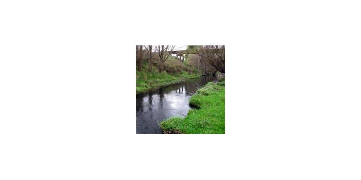
Redwood Springs Site One, Styx River
Site just upstream of the railway bridge in the Redwood Springs area, monitoring site #1.