Redwood Springs Site 3 - discontinued
The three Redwoods Springs water quality monitoring sites were set up to investigate the effects of the mall construction nearby. Redwoods 2 and 3 were located after the construction site run-off entered the river. We could therefore measure the water quality at these sites and compare the data to Redwoods 1 (located before the run-off entered the river) to see what effect the construction site was having on the health of the river.
With the construction of the mall now complete and all relevant data collected, we have discontinued the monitoring of the Redwood Springs sites and have started monitoring in three other locations along the Styx River and its tributaries.
The river is approximately 4m wide. The riverbed is silt/sand, with substantial macrophyte growth. The lower true right bank is grass/herb mix, and subject to flooding, with a steep slope behind rising to public reserve land. The true left bank is a swamp area, with a large variety of native and introduced plants.
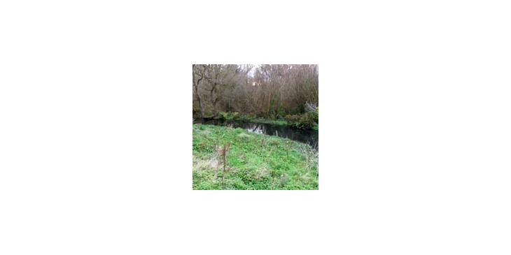
Redwood Springs Site Three, Styx River
Redwood Springs Site Three, Styx River, Christchurch, New Zealand