Smacks Creek Conservation Reserve - Discontinued
Waterway
Smacks Creek
Geolocation
-43° 27' 39.2364", 172° 35' 24.4896"
Location Description
Approximately 60 m downstream of crossing Gardiners Road.
Site Description
Just over 1 m wide. Riffle/fast run. Streambed: shallow with small cobble substrate. Some submerged macrophytes with emergent macrophytes on the true right bank. Substantial periphyton growth on the cobbles.
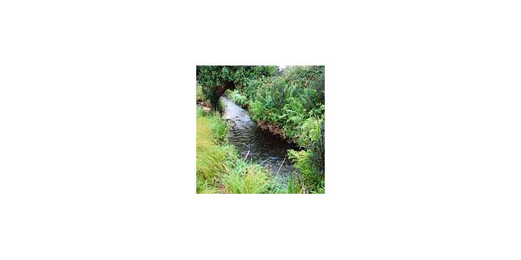
Smacks Creek
Smacks Creek monitoring spot on the Styx River, Christchurch
Copyright
Styx Living Laboratory Trust
Related Research